The reference system in NVDB
The reference system describes the physical road network and represents a digital, navigable road network. It forms the basis for all registrations in NVDB.
The reference system is often referred to as the road network in NVDB. It consists of networks for vehicles, pedestrians and cyclists, where the roads must either be longer than 50 metres or be part of a continuous network.
All road-related information in Norway is linear referenced through the reference system. In order to register road objects in NVDB, the reference system must be in place.
Roads under construction are also included in the reference system. This means that roads can be registered in NVDB before they are opened to traffic, so that road objects can be located at an early stage –often in connection with major projects.
The reference system consists of:
- Basisnett – a network of nodes and links on which all road objects are located
- Geometry - centre lines that show the road's location in the terrain
- Road system reference - describes the road authority, road number and which parts of the road network belong to the road in question
The digital navigable road network
The road network in NVDB is also part of the digital navigable road network. This consists of the reference system combined with road objects that provide more information about the road and make it navigable – such as addresses, speed limits, road closures and other traffic regulations.
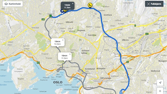
No road network – no routing
The digital navigable road network is the basis for route planning and is used by blue light agencies, among others. See an example in The Norwegian Public Roads Administration's route planning service.
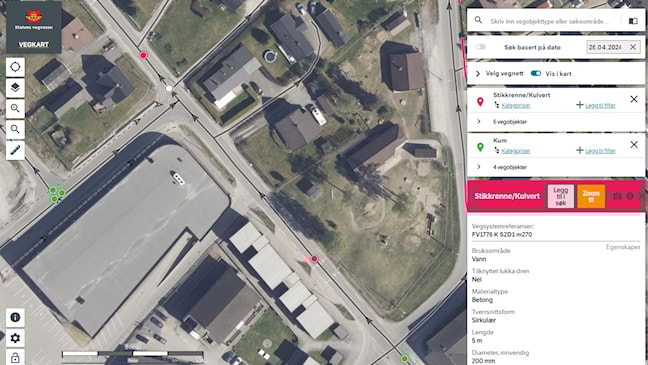
No road network - no registration in NVDB
Everything registered in NVDB is connected to the road network. In this way, road objects are given a road system reference, which shows which road they belong to and where on the road they are located. See an example in Vegkart.no
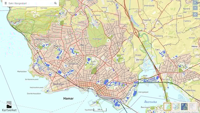
No road network - not shown on map
The road network from NVDB is used when you need a simplified view of roads in maps – for example, in thematic maps, address maps or hiking maps. See example in Norgeskart.no.
Want to learn more?
- Manual V830 National Road Reference System (PDF) provides a detailed description of the reference system.
- The road reference system in NVDB (PDF) comprises a fact sheet with a basic description of the road system reference.
- Course in the reference system (kilden.vegvesen.no) builds on the introductory course to NVDB and deals with road system, segment, metre value, intersection system, roadside structures and fields.
Also read about our customized product for navigable road networks: NVDB Route Dataset (geonorge.no)